Bước tới nội dung

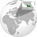
Tập tin:Georgia (orthographic projection with inset).svg

Nội dung trang không được hỗ trợ ở ngôn ngữ khác.
Từ điển mở Wiktionary

Tập tin gốc (tập tin SVG, 550×550 điểm ảnh trên danh nghĩa, kích thước: 689 kB)

Miêu tả

Miêu tả
English: The orthographic projection map of Georgia.
This is a Grey & green orthographic projection map.
العربية: الرجاء، قراءة الميثاق.
বাংলা: দয়া করে, রীতিনীতিটি পড়ুন
Deutsch: Bitte lies die Konventionen.
English: Please, read the conventions.
Español: Por favor, lea las convenciones.
Filipino: Paki-basa ang mga kumbensyon.
Français : S'il vous plaît, lisez les conventions.
हिन्दी: कृपया सभागमों को पढ़ लें.
Bahasa Indonesia: Silakan, baca konvensi.
Italiano: Si prega di leggere le convenzioni.
日本語: 規約をご確認ください。
ქართული: გთხოვთ, გაეცნოთ კონვენციებს.
Português: Por favor, leia as convenções.
Русский: Пожалуйста, прочитайте соглашения.
Українська: Будь ласка, прочитайте конвенції.
Tiếng Việt: Hãy đọc công văn trước khi đăng.
中文(繁體):請檢視常規
中文(简体):请查看常规
World maps

Africa

हिन्दी: अफ्रीका
ქართული: აფრიკა.

Eastern Africa

Southern Africa

Central Africa

Northern Africa

Western Africa

Americas

ქართული: ამერიკა.
हिन्दी: अमेरिका

North America

Central America

Caribbean

South America

Asia

ქართული: აზია.
Português: Ásia.
Українська: Азія.

East

Português: Ásia Oriental.
Українська: Східна Азія.

Central

हिन्दी: मध्य एशिया
Português: Ásia Central.
Українська: Центральна Азія.

Southeast

Bahasa Indonesia: Asia tenggara
Português: Sudeste Asiático.

South

(भारतीय उपमहाद्वीप)
Português: Sul da Ásia.
Українська: Південна Азія.

Western

Português: Sudoeste da Ásia.
Українська: Передня Азія.

Europe

हिन्दी: यूरोप
ქართული: ევროპა.
Português: Europa.
Română: Europa.
Русский: Европа.
Українська: Європа.

Countries

Oceania

हिन्दी: ओशिआनिया
ქართული: ოკეანეთი.
Português: Oceania.
Українська: Океанія.

Intercontinental

Português: Intercontinental.
Українська: Міжконтинентальні.

Historical

English: Unions, Organizations, Kingdoms, Empires
Español: Uniones, Organizaciones, Reinos, Imperios
Filipino: Mga Unyon, Organisasyon, Kaharian, Imperyo
Français : Unions, Organisations, Royaumes, Empires
हिन्दी: संघ, संगठन, राज्य, साम्राज्य व ऐतिहासिक देश
ქართული: გაერთიანებები, ორგანიზაციები, სამეფოები, იმპერიები
Português: Estados extintos.
Tagalog: Mga Unyon, Organisasyon, Kaharian, Imperyo
Українська: Союзи, Організації, Королівства, Імперії
中文(繁體):聯盟、組織、王國和帝國
中文(简体):联盟、组织、王国和帝国

Subnationals

हिन्दी: उपराष्ट्रीय इकाईयाँ
Ngày
Nguồn gốc

Own work based on: Georgia (orthographic projection).svg

Tác giả derivative work: Chipmunkdavis
Giấy phép
(Dùng lại tập tin)
w:vi:Creative Commons
ghi công chia sẻ tương tự
Tập tin này được phát hành theo Giấy phép Creative Commons Ghi công - Chia sẻ tương tự 3.0 Chưa chuyển đồi
Bạn được phép:
  • chia sẻ – sao chép, phân phối và chuyển giao tác phẩm
  • pha trộn – để chuyển thể tác phẩm
Theo các điều kiện sau:
  • ghi công – Bạn phải ghi lại tác giả và nguồn, liên kết đến giấy phép, và các thay đổi đã được thực hiện, nếu có. Bạn có thể làm các điều trên bằng bất kỳ cách hợp lý nào, miễn sao không ám chỉ rằng người cho giấy phép ủng hộ bạn hay việc sử dụng của bạn.
  • chia sẻ tương tự – Nếu bạn biến tấu, biến đổi, hoặc tạo tác phẩm mới dựa trên tác phẩm này, bạn chỉ được phép phân phối tác phẩm mới theo giấy phép y hệt hoặc tương thích với tác phẩm gốc.
Phiên bản khác ,
SVG genesis
InfoField
 
Mã nguồn của tập tin SVG này không hợp lệ do một lỗi.
 
This W3C-invalid world map was created with Inkscape.
Đây là một ảnh đã được chỉnh sửa, có nghĩa là nó đã được chỉnh sửa kỹ thuật số so với phiên bản gốc. Có thể xem phiên bản gốc tại đây: Europe Location Georgia uncontrolled highlighted.svg.

Nhật trình tải lên đầu tiên

This image is a derivative work of the following images:

  • Georgia (orthographic projection).svg licensed with Cc-by-sa-3.0
    • 2011-04-17T17:57:02Z Sigismun 550x550 (575027 Bytes) I have been yelled at that we are not allowed to rewrite existing maps. So why not create a separate file?
    • 2011-04-17T10:58:04Z Night w 550x550 (791516 Bytes) {{Information |Description ={{en|1=Locator map of Georgia}} |Source =Own work |Author =Night w |Date = |Permission = |other_versions = }} match up boxes, reduce lineage
    • 2011-04-17T10:16:42Z Night w 550x550 (801072 Bytes) try this?
    • 2011-04-17T10:11:14Z Chipmunkdavis 550x550 (716474 Bytes) Thickening green lines, light green colouring the same as the India map, adding light green to large map to match inset, shrinking inset slightly
    • 2011-04-17T08:42:59Z Night w 550x550 (738790 Bytes) added inset
    • 2011-01-08T00:04:53Z Kentronhayastan 550x550 (575027 Bytes) better quality
    • 2010-01-11T21:11:06Z Izzedine 680x680 (337039 Bytes) {{Information |Description={{en|1=Location of Georgia.}} |Source=Own work |Author=Izzedine |Date=2010-01-11 |Permission= |other_versions= }}
  • Europe Location Georgia uncontrolled highlighted.svg licensed with PD-self
    • 2011-04-17T09:09:50Z Chipmunkdavis 1024x1024 (532451 Bytes) Filling out the entire of Georgia, a little bit was missing in the southeast.
    • 2011-04-09T23:21:28Z Dinamik 1024x1024 (533250 Bytes) original version
    • 2011-04-09T23:10:44Z ComtesseDeMingrelie 1000x1000 (436609 Bytes) Reverted to version as of 13:07, 1 February 2011
    • 2011-02-01T17:14:28Z Chipmunkdavis 1024x1024 (533250 Bytes) Back to original. Arbitrary borders between continents do not need to be shown on any map showing the locations of countries. This is even more true with the undefined border between Europe and Asia, which changes depending o
    • 2011-02-01T13:07:16Z ‍Diaoha 1000x1000 (436609 Bytes) Difference between Asia and Europe must be seen.
    • 2011-01-30T14:27:42Z Chipmunkdavis 1024x1024 (533250 Bytes) Back to version at 03:45, 10 March 2010, original without the two different shades of grey
    • 2010-06-23T19:43:49Z Yuriy Kolodin 1000x1000 (436609 Bytes) No relation to Georgia. Georgia is not a member of EU
    • 2010-06-23T11:09:16Z ‍Diaoha 1000x1000 (2081069 Bytes) a
    • 2010-06-23T11:06:35Z ‍Diaoha 1000x1000 (2107459 Bytes) z:)
    • 2010-06-23T11:04:29Z ‍Diaoha 1000x1000 (2107459 Bytes) Minor
    • 2010-06-23T10:39:39Z ‍Diaoha 1000x1000 (440827 Bytes)
    • 2010-06-23T10:36:33Z ‍Diaoha 1000x1000 (436609 Bytes)
    • 2010-03-09T19:45:38Z Dinamik 1024x1024 (533250 Bytes) original version by Nicolay Sidorov
    • 2010-02-27T14:21:17Z ‍Diaoha 1024x1024 (533334 Bytes) No POV in Commons.
    • 2010-02-27T01:33:34Z Dinamik 1024x1024 (533250 Bytes) this file was transfered from ru-wiki by you;if you think,that it is POV-pushing,please,nominate it for deletion
    • 2010-02-26T08:59:56Z ‍Diaoha 1024x1024 (533334 Bytes) Reverted POV pushing.
    • 2010-02-26T00:26:40Z Dinamik 1024x1024 (533250 Bytes) please,choose for your file another name;don't overwrite the image of Nicolay Sidorov
    • 2010-02-25T07:17:08Z ‍Diaoha 1024x1024 (533334 Bytes) Reverted POV pushing.
    • 2010-02-24T22:30:49Z Dinamik 1024x1024 (533250 Bytes) please,don't overwrite somebody else's image by the another file with the same name;back to original version by Nicolay Sidorov
    • 2010-02-24T11:19:51Z ‍Diaoha 1024x1024 (533334 Bytes) Reverted Sepratistic propoganda.
    • 2010-02-24T05:40:47Z Hayk 1024x1024 (533250 Bytes) de-facto situation, revert to original version by Nicolay Sidorov
    • 2010-02-23T16:47:24Z ‍Diaoha 1024x1024 (533334 Bytes) Reverted Sepratistic propoganda.
    • 2010-02-22T15:47:48Z Dinamik 1024x1024 (533250 Bytes) if you think,that image of Nikolay Sidorov is non-encyclopaedic,you can nominate it for delection;please,don't overwrite it
    • 2010-02-21T14:52:20Z ‍Diaoha 1024x1024 (533334 Bytes) Reverted separatistic propaganda
    • 2010-02-20T19:19:28Z Dinamik 1024x1024 (533250 Bytes) we can make another map(without propaganda) and upload it,but with another name
    • 2010-02-19T15:20:41Z ‍Diaoha 1024x1024 (533334 Bytes) Reverted separatistic propaganda
    • 2010-02-18T23:07:27Z Hayk 1024x1024 (533250 Bytes) de-facto situation, revert to original version by Nicolay Sidorov
    • 2010-02-17T16:41:15Z ‍Diaoha 1024x1024 (533334 Bytes) Reverted to version as of 17:42, 16 February 2010
    • 2010-02-16T22:07:33Z Dinamik 1024x1024 (533250 Bytes) map gives information about de-facto situation;it isn't propaganda
    • 2010-02-16T17:42:37Z ‍Diaoha 1024x1024 (533334 Bytes) Reverted propaganda
    • 2010-02-16T16:19:29Z Hayk 1024x1024 (533250 Bytes) revert to original version by Nicolay Sidorov
    • 2010-02-16T03:29:55Z ‍Diaoha 1024x1024 (533334 Bytes) Stop separatistic propaganda
    • 2010-02-15T23:05:55Z Hayk 1024x1024 (533250 Bytes) don't overwrit image w/ standart grey-green colors, revert to original version by Nicolay Sidorov
    • 2010-02-15T11:44:43Z ‍Diaoha 1024x1024 (533334 Bytes) How long will you be supporting the separatists? The colours do it
    • 2010-02-14T21:42:33Z Dinamik 1024x1024 (533250 Bytes) colors can't support or oppose,they only give information;anyone can make another map with another name
    • 2010-02-14T08:27:15Z ‍Diaoha 1024x1024 (533334 Bytes) Colours that don't csupport separatists
    • 2010-02-08T05:30:13Z Dinamik 1024x1024 (533250 Bytes) old colors-standart grey-green maps colors;original version by Nicolay Sidorov
    • 2010-02-06T09:44:23Z ‍Diaoha 1024x1024 (533334 Bytes) new supposed colors are awful;readers consider them as separate states; back to original version
    • 2010-02-05T21:03:21Z Dinamik 1024x1024 (533250 Bytes) new supposed colors are too similar; back to original version
    • 2010-02-05T11:11:59Z ‍Diaoha 1024x1024 (533334 Bytes) (new supposed colors are awful;readers consider them as separate states)
    • 2010-02-02T20:59:07Z Dinamik 1024x1024 (533250 Bytes) new supposed colors are almost the same;readers don't see differences well
    • 2010-01-30T07:33:01Z ‍Diaoha 1024x1024 (533334 Bytes) Technikal correction
    • 2010-01-25T22:14:05Z Dinamik 1024x1024 (533250 Bytes) technical correction
    • 2010-01-25T22:12:51Z Dinamik 1024x1024 (533250 Bytes) If we want to upload file,that was done by the another principles,we should choose another name for it
    • 2010-01-24T07:46:23Z ‍Diaoha 1024x1024 (1075754 Bytes) f
    • 2010-01-24T06:46:47Z ‍Diaoha 1024x1024 (533250 Bytes) We CAN
    • 2010-01-23T22:39:35Z Dinamik 1024x1024 (533250 Bytes) technical correction
    • 2010-01-22T06:24:28Z Dinamik 1024x1024 (533250 Bytes) technical correction
    • 2010-01-22T06:23:10Z Dinamik 1024x1024 (533250 Bytes) original version by Nicolay Sidorov (was uploaded in ru-wiki)
    • 2010-01-20T11:36:56Z ‍Diaoha 1024x1024 (527293 Bytes) Discuss first, gentlemen.

Uploaded with derivativeFX

Annotations
InfoField
This image is annotated: View the annotations at Commons

Chú thích

Ghi một dòng giải thích những gì có trong tập tin này
Georgia on map

Khoản mục được tả trong tập tin này

mô tả

Lịch sử tập tin

Nhấn vào ngày/giờ để xem nội dung tập tin tại thời điểm đó.

Ngày/GiờHình xem trướcKích cỡThành viênMiêu tả
hiện tại11:54, ngày 26 tháng 6 năm 2020Hình xem trước của phiên bản lúc 11:54, ngày 26 tháng 6 năm 2020550×550 (689 kB)HogweardSouth Sudan border
03:52, ngày 19 tháng 11 năm 2016Hình xem trước của phiên bản lúc 03:52, ngày 19 tháng 11 năm 2016550×550 (701 kB)ChipmunkdavisRevert to standard conventions. All lines appearing on my monitor, possibly a browser issue.
07:49, ngày 26 tháng 10 năm 2016Hình xem trước của phiên bản lúc 07:49, ngày 26 tháng 10 năm 2016550×550 (2,39 MB)Giorgi BalakhadzeI wrote that when it is shown in 250px in articles Abkhazia all disappears, this pattern better saves contours.
01:53, ngày 26 tháng 10 năm 2016Hình xem trước của phiên bản lúc 01:53, ngày 26 tháng 10 năm 2016550×550 (701 kB)GyumrilakReverted to version as of 21:59, 23 July 2011 (UTC) Why are you doing that? The unrecognized regions were represented well already.
18:35, ngày 25 tháng 10 năm 2016Hình xem trước của phiên bản lúc 18:35, ngày 25 tháng 10 năm 2016550×550 (2,39 MB)Giorgi BalakhadzeRemoving hidden layers. Pattern lines for better representation of the country's north-west border when the file is used in articles. (it disappears with light green)
21:59, ngày 23 tháng 7 năm 2011Hình xem trước của phiên bản lúc 21:59, ngày 23 tháng 7 năm 2011550×550 (701 kB)Night wshading extension and lines
02:08, ngày 2 tháng 7 năm 2011Hình xem trước của phiên bản lúc 02:08, ngày 2 tháng 7 năm 2011550×550 (699 kB)Kentronhayastanupgraded the style of the inset
09:07, ngày 18 tháng 4 năm 2011Hình xem trước của phiên bản lúc 09:07, ngày 18 tháng 4 năm 2011550×550 (700 kB)Chipmunkdavis{{Information |Description={{en|1=Location of Georgia.}} {{ru| {{en|1={{EU-SVG-en|Georgia}}}}. карта расположения Грузии}} |date = 2009 |Source=*File:Georgia_(orthographic_projection).svg *[[:File:Europe_Location_Georgia

Trang sau sử dụng tập tin này:

Sử dụng tập tin toàn cục

Những wiki sau đang sử dụng tập tin này:

Xem thêm các trang toàn cục sử dụng tập tin này.

Đặc tính hình